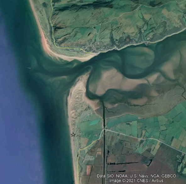
Various stretches of the Welsh coastal dunes have been exposed to vulnerability (Williams and Davies 2001), yet estimation of risks are mostly qualitative with more emphasis on description(Caldwell and Yule 1981)rather than prediction. Dynamic modelling of how such dune faces would reshape during extreme events such as storms accompanied by high tides would aid in risk evaluation. Dune geomorphology is a crucial physical boundary for the growth of plants within the dune ecosystem. As a proof of concept, the erosion of the Ynylas dune (Ceredigion, GB) would be simulated for local extreme events such as the January 2014 storm.
A cascading analysis will be used. Firstly, oceanographic conditions associated with the storm event should be determined. This task is done through hydrodynamic modelling with commonly used open-source software such as Swan, XBeach, and Duna. The wave condition is validated against limited data published (Thompson et al. 2017), and also some recent LiDAR data kindly provided by the Wales Coastal Monitoring Centre.
Secondly, the output of such simulation model is analysed to highlight major driving forces to the change of this beach: waves, storm surge and wind. In addition, the background evolution of beach morphology due to the tidal process is considered (Robins and Davies 2010).
Participants: Nguyen Quang Chien, Dept. Physics and Hywel Griffith, Dept. Geography, Aberystwyth University ,
Peter Robins, Bangor University
Dano Roelvink, IHE-Delft
Charlotte Lyddon, University of Liverpool
Joy-Welch Charitable Fund.
Photo credits: weareaway (Pixabay) •